|
|
Post by hodgy on Oct 12, 2016 17:23:24 GMT
|
|
|
|
Post by scott on Oct 12, 2016 17:42:42 GMT
It looks like a part of Scotland but may be misleading, however it looks like a cracker of a place to ride
|
|
|
|
Post by scott on Oct 12, 2016 17:43:49 GMT
It'll be cragside or summit lol
|
|
|
|
Post by ktmfiveforty on Oct 12, 2016 17:48:27 GMT
No idea where ... but WOW!!! 
It reminds me of where I'm going for a bimble in a week or so hopefully .. but yours looks a little more rugged  |
|
|
|
Post by marsbarman on Oct 12, 2016 17:52:10 GMT
I need to ride that.. it looks incredible!
|
|
|
|
Post by hodgy on Oct 12, 2016 18:05:16 GMT
Andy..( edit ..sorry I meant Scott !..dementia already lol) I can see why you would think it's Scotland ..it does look very " Scottish " ..as in good !
It is in The Lake District though ..but before the big reveal ..please remember that it is a footpath ..I chose to ride it today because it's mid week and out of holiday season..but the car park was still full ..ramblers with better known trails to fry from the same starting point .
I did meet people walking this trail who were all very pleasant ..but at a weekend it could be very different when groups of wooly hats get together!
I will leave it open for a little while longer ..lol
|
|
|
|
Post by kirky72 on Oct 12, 2016 18:05:22 GMT
The lakes.
What do I win??
|
|
|
|
Post by kirky72 on Oct 12, 2016 18:06:38 GMT
Typed that before you revealed.
Is it around Coniston water somewhere.
|
|
|
|
Post by hodgy on Oct 12, 2016 18:09:53 GMT
Nope ..but a lemsip for getting close ..but no where near Coniston !
|
|
|
|
Post by kirky72 on Oct 12, 2016 18:14:03 GMT
Sorry I meant ulswater shore. It's a good track isn't it.
|
|
|
|
Post by roundie1981 on Oct 12, 2016 18:14:18 GMT
Not a chuffing clue but it looks a great place to try, been working in glossop today and it looks good for riding too, think that's the peaks, somewhere I've not ridden before and only an hour away. 👍
|
|
|
|
Post by hodgy on Oct 12, 2016 18:22:55 GMT
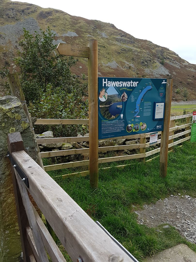
In the shadow of Nan Bield & Gatesgarth pass ..which is where most folk head from this car park ..it's the North Shore Path .. Further research required in terms of trying the two bridleways mentioned earlier ..but it will make it a big big ride if it works out ...  |
|
|
|
Post by glynnsixo on Oct 12, 2016 18:37:55 GMT
roundie you need to put that right. give us a shout if you're up for a mid-weeker.
great pics neil
|
|
|
|
Post by roundie1981 on Oct 12, 2016 19:05:20 GMT
roundie you need to put that right. give us a shout if you're up for a mid-weeker. great pics neil I was thinking that's your neck of the woods, will have to get down there with you sometime |
|
|
|
Post by Chopper on Oct 12, 2016 19:09:09 GMT
looks good Hodgy  |
|
|
|
Post by Marmite on Oct 12, 2016 20:00:54 GMT
Looks good cheeky path  |
|
|
|
Post by kalli on Oct 12, 2016 21:16:05 GMT
Isn't that quite close to honister pass?? Like on the other side by Buttermere?? While on the subject of that area,up by the slate quarry was a bridle way that was marked on the maps. It looked like it would have been good to ride down but i didn't know how to ride to it from the other way. It didn't look like it was included in any ride maps I had. Sorry for the hijack just pushing my luck to see if you had any local knowledge of a route to incorporate it?  |
|
|
|
Post by hodgy on Oct 13, 2016 6:04:25 GMT
Kalli...
I can see how you would make that assumption as there is a Gatesgarth over by Buttermere ..and I mentioned Gatesgarth Pass ..they are however two totally separate places ..as with other place names in the Lakes they are not slow to name them twice ( Borrowdale being another).
This is a lot further to the east of that area and closest to Shap than anywhere else and a bloody nightmare to get to as the roads are singletrack and the locals drive like lunatics !( or should that be like myself ..thinking I'm the only driver on the road !).
I'm familiar with the Slate mine you mentioned though ..but can't figure out which b/ way you mean ..any chance you can give a little more info?
Ta .
Edit: if it's the Slate mine at the top of Honister Pass heading towards the Buttermere area ..I haven't ridden in those parts ..maybe Windy would have more of an idea ?
|
|
|
|
Post by kalli on Oct 13, 2016 7:09:49 GMT
Yeah honister slate mine I'm on about. There's a rough track down to the mine car park from the top that's marked as bridle way. Can't seem to get any other info on it than that. We had a lakes book with bike routes on it but it wasn't in there:-(
|
|
|
|
Post by Rlo80 on Oct 13, 2016 8:41:37 GMT
I can't read English so the signs mean nothing to me...they are just arrows for trails to be ridden.
|
|
|
|
Post by dirkpitt74 on Oct 13, 2016 8:41:45 GMT
That looks brilliant Hodgy.
|
|
|
|
Post by windysurfer on Oct 13, 2016 15:48:00 GMT
Yeah honister slate mine I'm on about. There's a rough track down to the mine car park from the top that's marked as bridle way. Can't seem to get any other info on it than that. We had a lakes book with bike routes on it but it wasn't in there:-( Only ridden over that side of the Lakes once (over Blacksail pass) and it was a really tough ride! Not particularly enjoyable just tough. The slate mine is included in the route below www.glowingcoast.co.uk/rightsofway/mtb/buttermere03.htm |
|
|
|
Post by windysurfer on Oct 13, 2016 15:53:53 GMT
I've overnighted on the carpark at the end of the road a Haweswater. Nice and remote and has/had the only pair of nesting Golden Eagles in the UK!
Often wondered about a route from Pooley bridge, up Highstreet then down to Haweswater but not sure how ridable it would be.
|
|
|
|
Post by hodgy on Oct 13, 2016 17:17:50 GMT
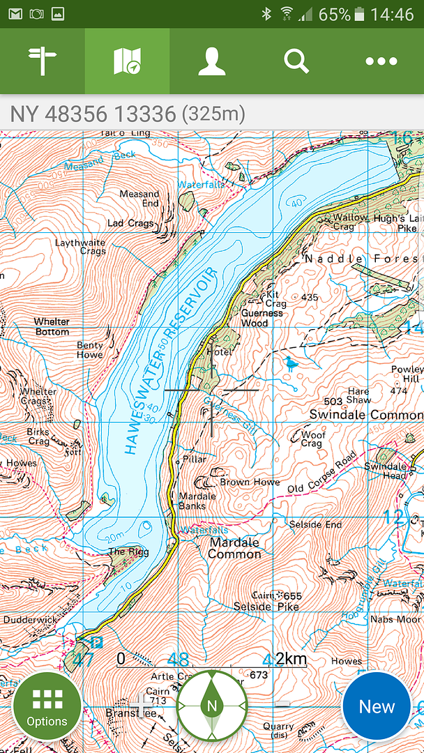
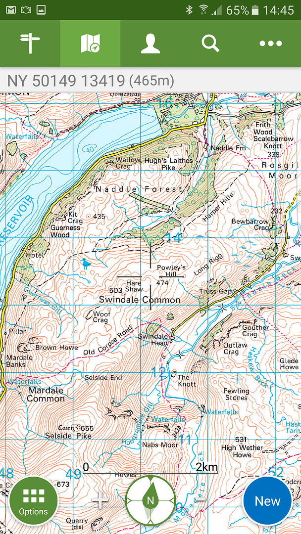
Not sure about that Golden Eagle statistic Gaz ..there are lots in Scotland and Northumberland also has a pair ...but it did say on that board that they were not currently resident . Looking at the map(s)   The route I was pondering starts at the car park and does the naughty section on the north shore first ( don't think it would ride as well in the other direction) Passing through Burnbanks to pick up the b/way over Naddle Farm to the road beyond Bewbarrow Crags..hanging a right to follow the road to Swindale Head and crossing over the Old Corpse Road to the road beyond Mardale Common .. I don't know how these would work out but do know that the initial climbs would be a push for most folks ..( look at the contours !) But if they had to transport coffins over here ...then it surely must be doable !? Maybe one for drier weather and in a quiet time .. |
|
|
|
Post by windysurfer on Oct 14, 2016 6:22:13 GMT
By UK I actually meant England and it was probably 10 years ago but lets not let facts stand in the way of an interesting post  Might have to have another explore around that area. Have you ever ridden around Thirlmere? There a tasty looking footpath runs all the way round that too |
|